After all Dakota land was taken and the Dakota were abolished from the state of Minnesota, every treaty signed with the Santee was nullified.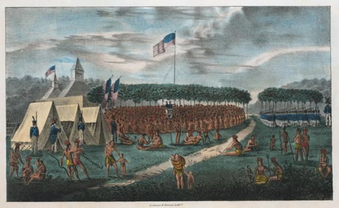 Treaty at Prairie Du Chien, signed August 19, 1825 Treaty at Prairie Du Chien, signed August 19, 1825 1825 – A treaty is signed in Michigan Territory with the Sioux, Chippewa, and others, allegedly, to introduce map boundaries to native tribes and to establish the idea of land ownership to lessen inter-tribal wars. It was the first step in the process of identifying land parcels for ownership by native people. It set the stage for the U.S. Government to set future reservation boundaries, and to identify future parcels to be ceded (sold for money and promised goods). The same strategy was used time and again as white settlement moved further into Indian land. In 1851, the tactic had spread westward into Dakota Territory with the signing of the Horse Creek Treaty/Fort Laramie Treaty of 1851, when lines on a map divided land in similar fashion. That same year, map marking in Minnesota Territory had advanced to the point of ceding nearly all Dakota controlled land to the U.S. Government and establishing a strip of land 10-miles wide, 130-miles long on each side of the Minnesota River for the Dakota to control. To read more, access The Thirty-Ninth Man, click here.
0 Comments
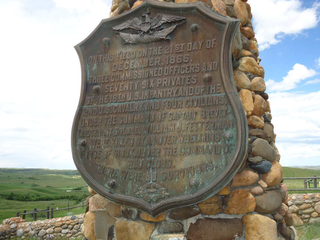
Commitment, Servitude, and Honor may best describe them. |
AuthorAt seventy-nine, I’m at the beginning of a new chapter in a life filled with blessings from above, adventure, love of family, and kinships reaching into the heavens and to God himself. —AND— I love to tell a story. Archives
May 2021
Categories |
 RSS Feed
|

|